Aerial Photography
MAVTech has been providing aerial photogrammetry services for many years through the use of its SAPRs for the generation of orthophotos, digital terrain models and three-dimensional point clouds.
Among the main scenarios are civil and road engineering sites, for which it is necessary to generate digital models in order to correctly plan the design works.
Technologies & Tools
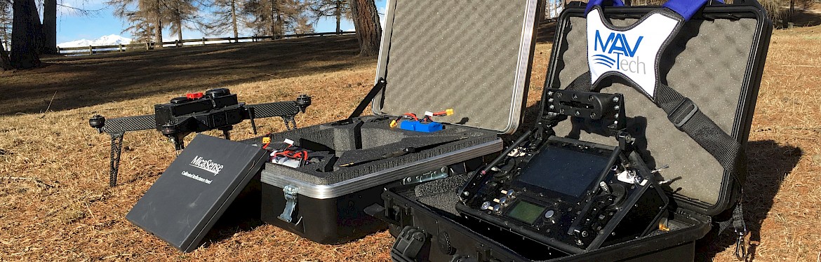
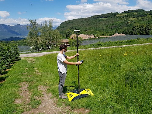
To carry out the photogrammetric surveys, images are acquired using a compact digital camera mounted on board a Remotely Piloted Aircraft Systems (RPAS) and some known GPS positions on the ground are recorded using the Emlid Reach RS2 GNSS satellite receiver and markers fixed to the ground.
The camera is mounted nadirally on board the drone by means of a stabilized quick-release system. The GNSS station is used to acquire known positions on the ground, and then use them in post-processing in order to further improve the georeferencing of the generated data.
Survey Planning
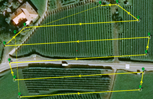
In order to ensure sufficient coverage of the area of interest, as well as to obtain a number of acquired images essential for proper post-processing, flight missions are planned with a high photo overlap (70-80%).
Thanks to the functionalities of the planner (Mission Planner), the drone is able to maintain a constant distance from the ground, following the terrain slopes.
The achievable ground resolutions are about 2 cm/pixel.
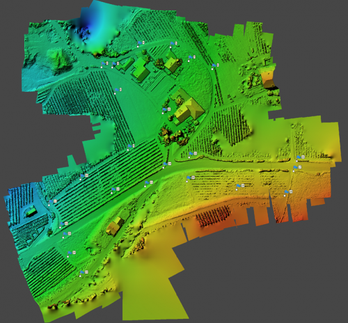
Data Processing
Agisoft Metashape Professional software is used to process the data set, which allows a large amount of output data to be generated, including:
- Point Cloud
- 3D Digital Model (Mesh)
- Digital Surface Model (DSM) and Digital Terrain Model (DTM)
- High Resolution Ortophoto
- Processing Quality Report (georeferencing accuracy, data resolution, ...)