Mapping fluvial areas with Q4E - WEQUAL PROJECT
Introduction
Introduction
This blog shows how to plan a flight mission with Q4E drone for surveys on river areas, in addition to the results obtained with the multispectral sensor Micasense RedEdge-M available on the webpage.
The survey was carried out as part of the research and development project WEQUAL, a project funded by the Autonomous Province of Bolzano (EFRE call for proposals), which sees the collaboration of MAVTech srl with Maccaferri Innovation Center, Naturstudio and Free University of Bolzano.
The objective of the project is the creation of a web platform to serve the designers and technicians of public administrations to conduct monitoring activities of river areas and assess the environmental, economic and social impact of design alternatives of hydraulic works.
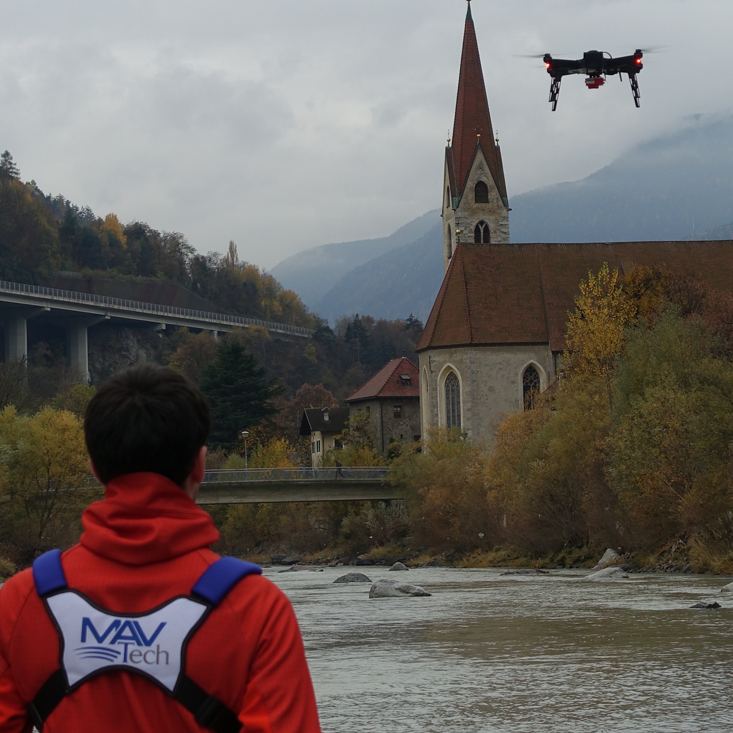
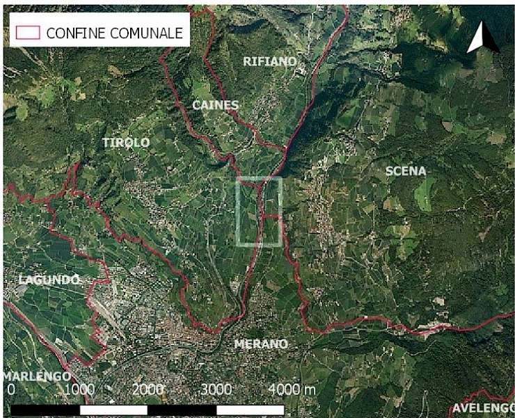
The survey took place at the site located on the Passirio river, in a very interesting area for the project's objective, situated in the municipalities of Merano, Scena and Tirolo. MAVTech is an operator recognized by ENAC for carrying out non-critical operations with SAPR and has received the authorization from the Mayors of the territories overflown to carry out this type of activities.


Survey Planning
Survey planning
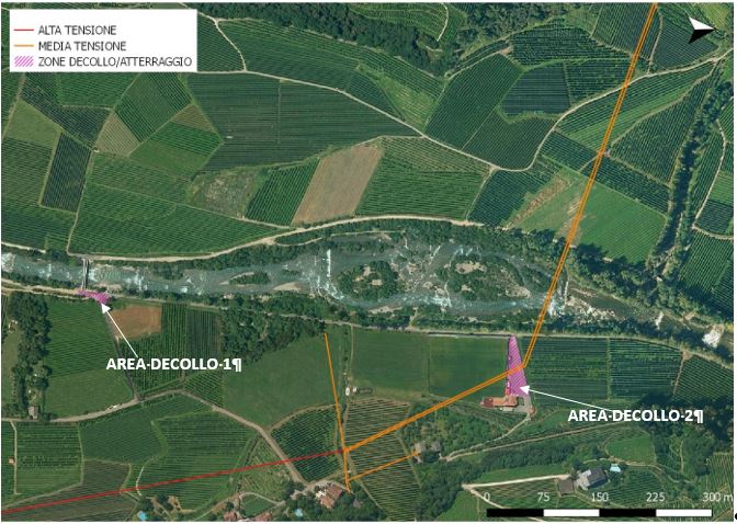
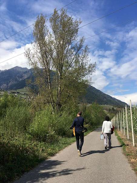
First of all, a walking inspection was carried out, in order to better evaluate the possible take-off and landing points, the flight plans and the flight obstacles present on the area to be flown over. The area considered had in fact structures of different types at a sufficient height to cause a risk for automatic flight, if this was not set correctly by evaluating all possible obstacles.
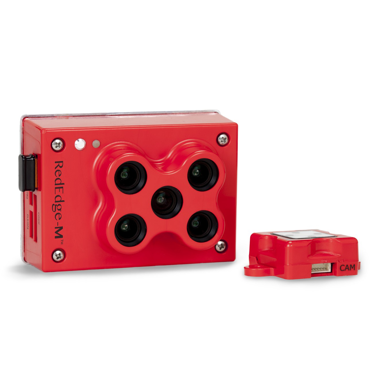
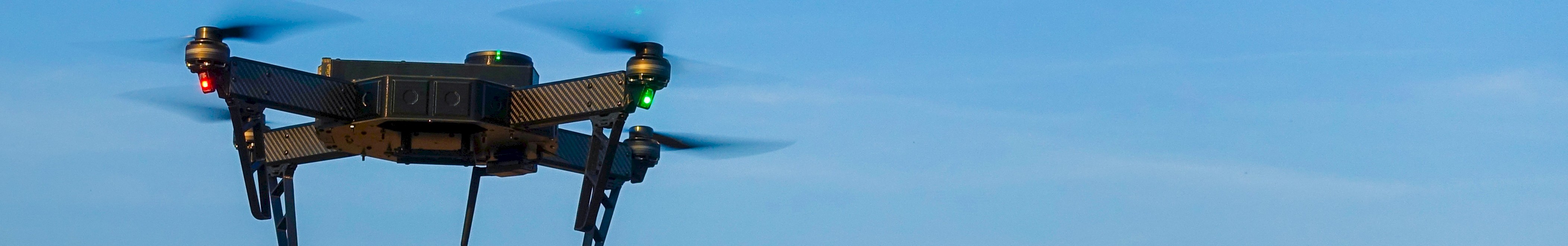
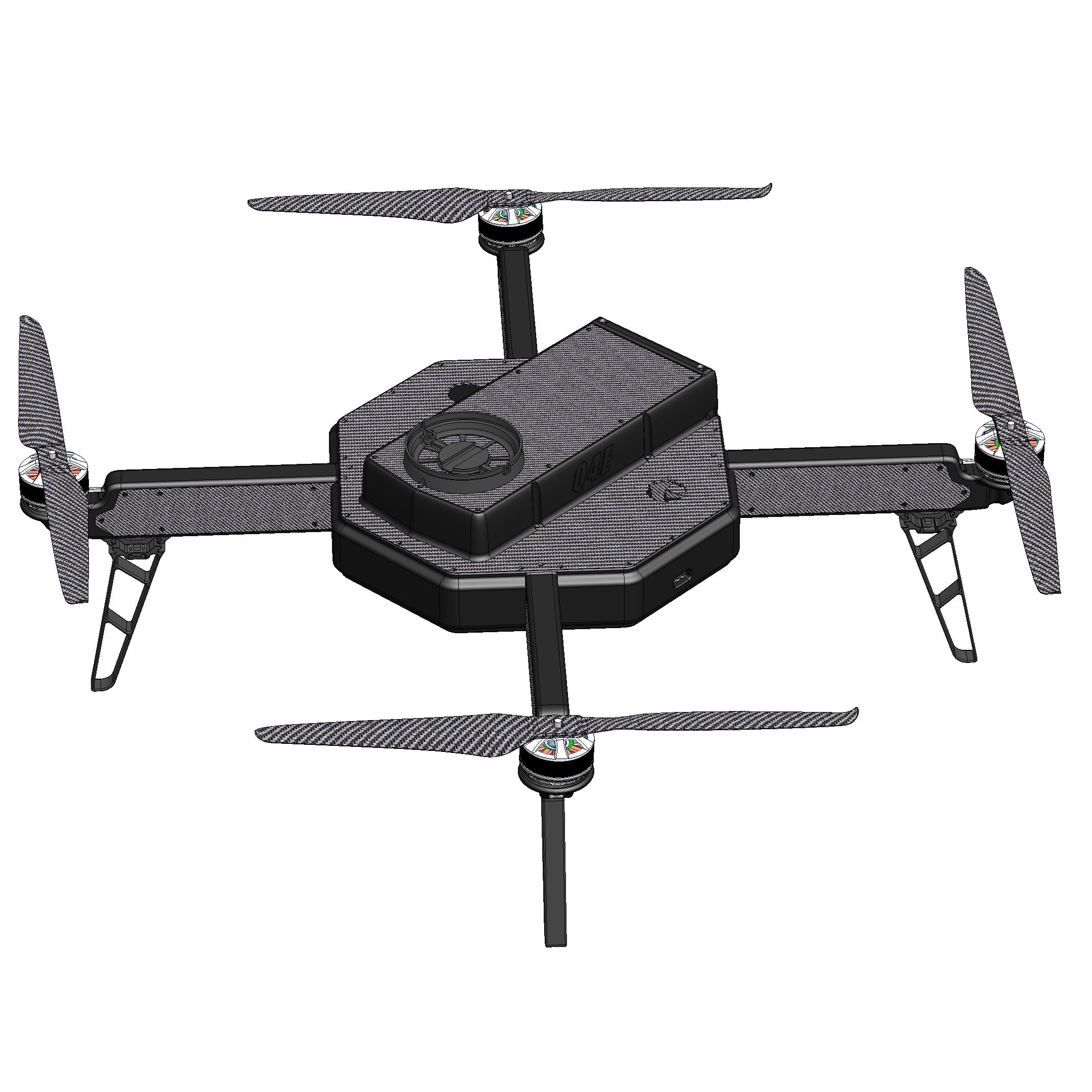
The survey was carried out with the Q4E drone, made by MAVTech, equipped with Micasense RedEdge-M multispectral sensor.
The flight mission was then planned with the Mission Planner software, which is integrated inside the Ground Control Station RADIOMAV.
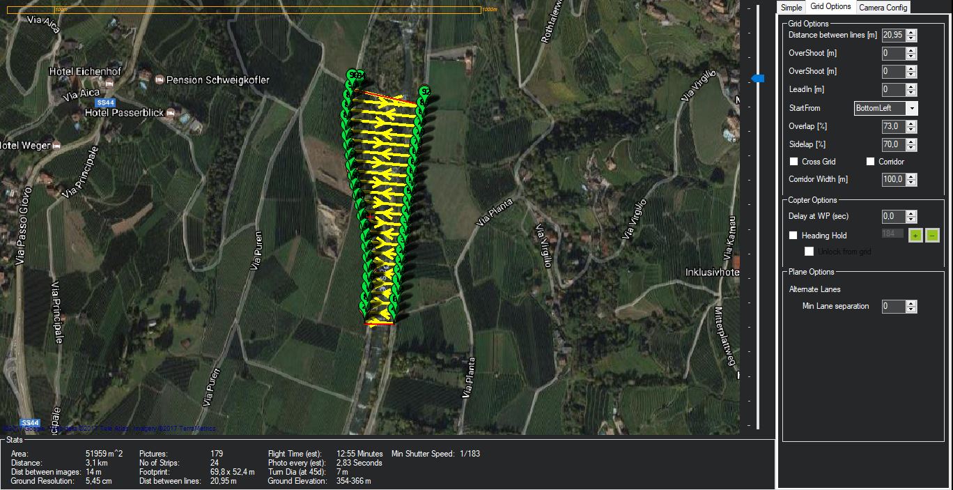
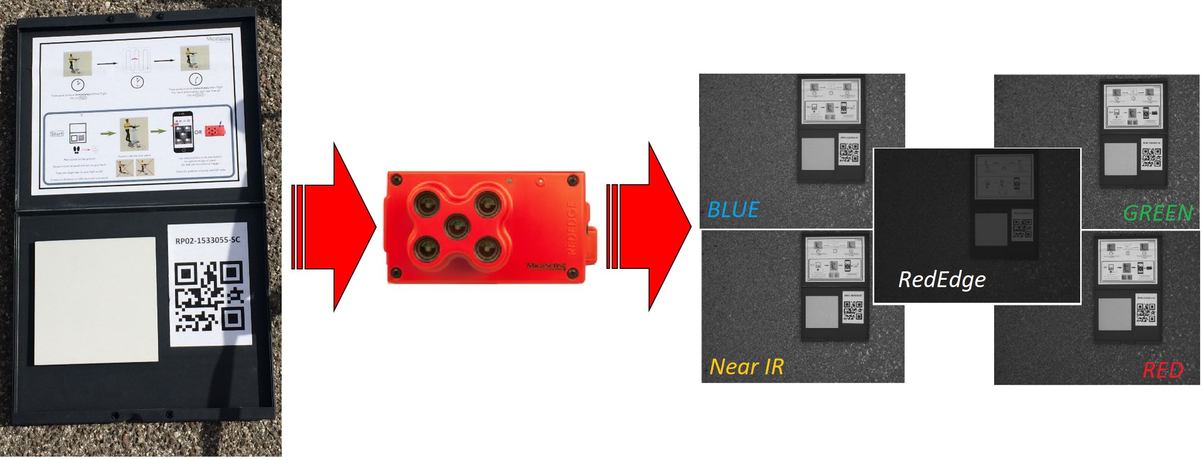
The flight mission lasted about 15 minutes, during which 179 multispectral images were acquired (5 for each acquisition band of the Micasense RedEdge-M sensor). Furthermore, before and after the flight, the optics of the multispectral sensor were calibrated using the reflectance panel supplied with the Micasense RedEdge-M multispectral camera. As its name suggests, the reflectance calibration panel is used to calibrate images acquired during a survey, taking into account the ambient brightness during the flight.
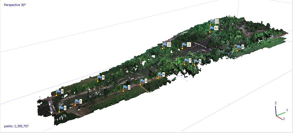
In addition, 15 ground points were acquired with high-precision GPS to improve the georeferencing of the final processing through corrections with RTK (Real Time Kinematic) data. Multispectral images were then processed with Agisoft Photoscan and Pix4D software.
RESULTS
Results
Once the post-processing of the acquired data has been completed, the results obtained are those shown in the images below.
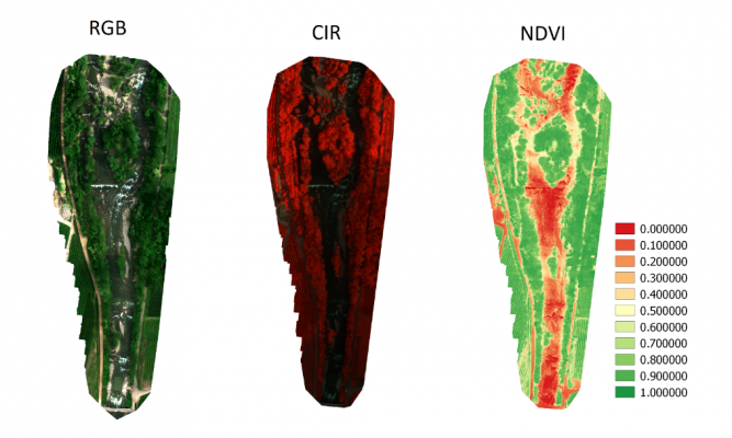
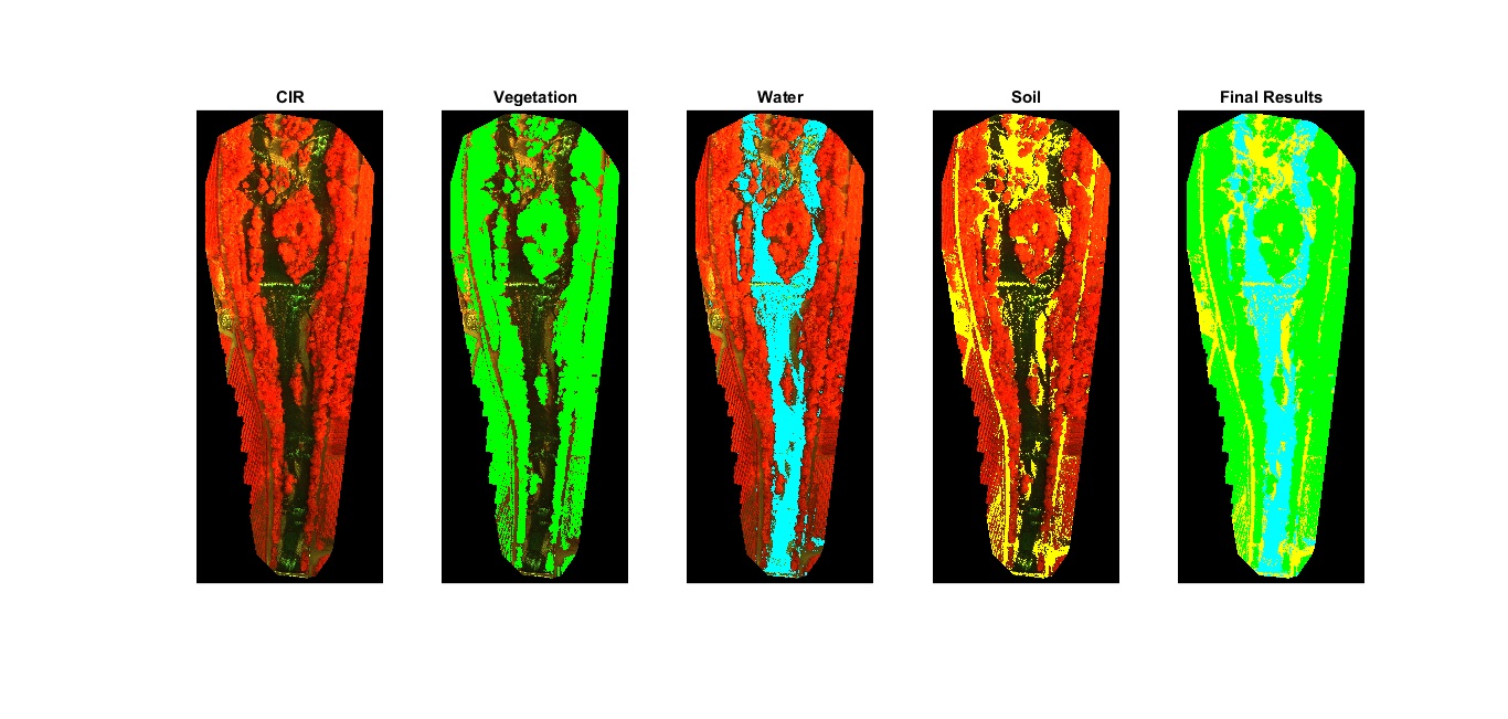
Through further processing with appropriate algorithms, it is possible to obtain the land use map of the surveyed site through the analysis of multispectral information acquired. In the figure below there is an example of a result obtained in the case in survey of the River Passirio in the province of Bolzano.
Acknowledgement
Acknowledgement
We would like to thank the mayors of the municipalities of Tirolo, Merano and Scena for their willingness to fly over their municipal territories.